Log in
All resources
Create a design
44,876 Free Images of Historic Map
bibliothèque nationale de france
a map of the british empire in america with the french and spanish settlements adjacent thereto
1730s maps of the caribbean
butterfly
historic butterfly plates
coding da vinci: süd 2019
leibniz institute for east and southeast european studies
map of vienna by jacob hoefnagel
historical images of vienna
jacob hoefnagel
atlas géographique des quatre parties du monde (delisle)
map of scandinavia by guillaume de l'isle (1706)
atlas géographique des quatre parties du monde (delisle)
map of scandinavia by guillaume de l'isle (1706)
map of maastricht by willem and johannes blaeu (1649)
first medieval city wall of maastricht
turgot map of paris, kyoto university library – derivative files
hôtel de guénégaud (quai de nevers)
a map of the british empire in america with the french and spanish settlements adjacent thereto
1730s maps of the caribbean
a map of the british empire in america with the french and spanish settlements adjacent thereto
1730s maps of the caribbean
a map of the british empire in america with the french and spanish settlements adjacent thereto
1730s maps of central america
a map of the british empire in america with the french and spanish settlements adjacent thereto
1730s maps of the caribbean
william de la montagne cary
battle of bad axe
zur geschichte der kartographie nordalbaniens (map reconstructions)
coding da vinci: süd 2019
map collection of leibniz-institut für ost- und südosteuropaforschung
1733 maps of europe
african american culture in popular 19th and early 20th century american music
jealousy in music
historic (pre-expansion) views of the united states capitol
daguerreotypes of the united states
a map of the british empire in america with the french and spanish settlements adjacent thereto
maps in the library of congress
map of paris by braun & hogenberg - derivative files
rue des archives (paris)
pictorial works
butterfly
identification
butterfly
identification
butterfly
pictorial works
butterfly
identification
butterfly
paintings of native americans by henry f. farny
1900 portrait paintings of men
map of paris by braun & hogenberg - derivative files
porte barbette
map of vienna by jacob hoefnagel
roter turm, vienna
brazilian paintings in the museu antônio parreiras
antônio rafael pinto bandeira
historical images of graben (vienna)
map of vienna by jacob hoefnagel
historical images of the place dauphine (paris)
place dauphine on maps
history of whitby, north yorkshire
british library maps collections
paintings of native americans by henry f. farny
henry farny in the cincinnati art museum
nicolas sanson. “mappe-monde, ou carte generale du monde.”
map of the bosphorus strait by guillaume sanson (1665)
grigory anikiyevich kachalov
mikhail makhaev
map of maastricht by willem and johannes blaeu (1649)
first medieval city wall of maastricht
prints by romeyn de hooghe
1689 map of haarlem
early netherlandish painting
t and o map
a map of the british empire in america with the french and spanish settlements adjacent thereto
bibliothèque nationale de france
a map of the british empire in america with the french and spanish settlements adjacent thereto
bibliothèque nationale de france
a map of the british empire in america with the french and spanish settlements adjacent thereto
bibliothèque nationale de france
a map of the british empire in america with the french and spanish settlements adjacent thereto
bibliothèque nationale de france
a map of the british empire in america with the french and spanish settlements adjacent thereto
bibliothèque nationale de france
a map of the british empire in america with the french and spanish settlements adjacent thereto
bibliothèque nationale de france
a map of the british empire in america with the french and spanish settlements adjacent thereto
bibliothèque nationale de france
a map of the british empire in america with the french and spanish settlements adjacent thereto
bibliothèque nationale de france
a map of the british empire in america with the french and spanish settlements adjacent thereto
bibliothèque nationale de france
a map of the british empire in america with the french and spanish settlements adjacent thereto
bibliothèque nationale de france
a map of the british empire in america with the french and spanish settlements adjacent thereto
bibliothèque nationale de france
a map of the british empire in america with the french and spanish settlements adjacent thereto
bibliothèque nationale de france
a map of the british empire in america with the french and spanish settlements adjacent thereto
bibliothèque nationale de france
a map of the british empire in america with the french and spanish settlements adjacent thereto
bibliothèque nationale de france
a map of the british empire in america with the french and spanish settlements adjacent thereto
bibliothèque nationale de france
a map of the british empire in america with the french and spanish settlements adjacent thereto
bibliothèque nationale de france
a map of the british empire in america with the french and spanish settlements adjacent thereto
bibliothèque nationale de france
a map of the british empire in america with the french and spanish settlements adjacent thereto
bibliothèque nationale de france
a map of the british empire in america with the french and spanish settlements adjacent thereto
bibliothèque nationale de france
a map of the british empire in america with the french and spanish settlements adjacent thereto
bibliothèque nationale de france
a map of the british empire in america with the french and spanish settlements adjacent thereto
bibliothèque nationale de france
a map of the british empire in america with the french and spanish settlements adjacent thereto
bibliothèque nationale de france
a map of the british empire in america with the french and spanish settlements adjacent thereto
bibliothèque nationale de france
a map of the british empire in america with the french and spanish settlements adjacent thereto
bibliothèque nationale de france
maps of oxia palus quadrangle
mars topography
frémont and '49 - the story of a remarkable career and its relation to the exploration and development of our western territory, especially of california (1914)
sutter's fort - historic drawings
a map of the british empire in america with the french and spanish settlements adjacent thereto
1730s maps of the caribbean
city walls of vienna
views of vienna
maps of ancient israel by philippe de la rué
map of modern syria by philippe de la rué
historical images of vienna
schottenkirche, vienna
louis dalrymple's puck covers
1901 covers of puck magazine
edward troye
orientalism
sketches of hudson bay life
1880 in british columbia
military equipment of muscovite russia
details of sigismund's map of moscow
historic images of the plaza de la constitución (mexico city)
plaza de la constitución (mexico city) in art
historic images of the plaza de la constitución (mexico city)
historical images of the mexican national palace
maps from traité de la police, bibliothèque nationale de france
fifth map of paris from traité de la police
maps from traité de la police, bibliothèque nationale de france
first map of paris from traité de la police
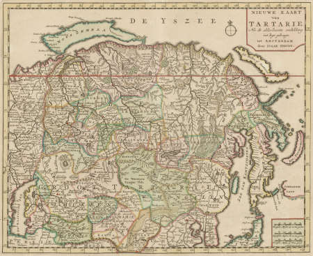
map collection of leibniz-institut für ost- und südosteuropaforschung
18th-century maps of siberia
paintings by antônio parreiras in the museu antônio parreiras
portrait paintings by antônio parreiras
lawrence h. slaughter collection of english maps, charts, globes, books and atlases
nypl lionel pincus and princess firyal map division
english-language maps from ios map collection
classicism
prints of cartouches in the rijksmuseum amsterdam
etchings in the rijksmuseum amsterdam
maps of paris from the david rumsey historical map collection
1778 in paris
maps of paris from the david rumsey historical map collection
1774 in paris
german flag
communism
prints by marius bauer in the rijksmuseum amsterdam
orientalism
eliphalet brown jr.
1854 in japan
old submaps of paris 3e arrondissement
rue du temple (paris)
harper's weekly illustrations by thomas nast
different races of people together in art
atlas des anciens plans de paris by imprimerie nationale, 1880 from bhvp
map of paris by jouvin de rochefort (boutier 112)
atlas maior, vol 3 (germany) - joan blaeu, 1667 - bl 114.h(star).3
old maps of moravia
atlas des anciens plans de paris by imprimerie nationale, 1880 from bhvp
map of paris by françois quesnel
atlas des anciens plans de paris by imprimerie nationale, 1880 from bhvp
map of paris by françois quesnel
admiralty charts region r: usa and mexico west coasts
admiralty charts 401-600
exterior of the morris-jumel mansion
balconies in new york city
postcards with views of ljubljana castle from prešeren square
20th-century postcards of ljubljana
william henry toms
henry popple
japanese prints in the walters art museum
ukiyo-e
turgot map of paris, kyoto university library – derivative files
lycée henri-iv
the century book of famous americans - the story of a young people's pilgrimage to historic homes (1896)
pocahontas (after simon van de passe - national portrait gallery, washington)
historical images of the mexican national palace
albumen prints in the rijksmuseum amsterdam
lawrence h. slaughter collection of english maps, charts, globes, books and atlases
nypl lionel pincus and princess firyal map division
brazilian paintings in the museu antônio parreiras
antônio rafael pinto bandeira
niagara by frederic edwin church
hudson river school
buildings in greenwich, connecticut
1889 in sports
postcards of new mexico published by petley studios
curt teich postcard archives
5401 - 5500 of 44,876
Next page
/ 449


![Lutetia or first plan of the city of Paris taken from Cesar, Strabo, the Emperor Julian and Ammiam Marcellin [Digitized still image] / By MLCDLM, Antoine Coquart](https://cdn.creazilla.com/illustrations/10001224733/lutetia-or-first-plan-of-the-city-of-paris-taken-from-cesar-strabo-the-emperor-julian-and-ammiam-marcellin-digitized-still-image-by-mlcdlm-antoine-coquart-md.png)